There are many potential threats to drinking water. The Clean Water Act, 2006 identifies specific activities that pose a risk of contamination. The task of the CTC Source Protection Committee is to ensure that each of the existing or potential threats to municipal sources of drinking water in the CTC Source Protection Region are eliminated.
Threats to Drinking Water
As prescribed by the Ontario Ministry of the Environment, Conservation and Parks:
1. The establishment, operation or maintenance of a waste disposal site within the meaning of Part V of the Environmental Protection Act.
2. The establishment, operation or maintenance of a system that collects, stores, transmits, treats or disposes of sewage.
3, 4, 5. The application, handling and storage of Agricultural Source Material (ASM).
6, 7. The application, handling and storage of Non-Agricultural Source Material (NASM).
8, 9. The application, handling and storage of Fertilizer.
10, 11. The application, handling and storage of Pesticide.
12, 13. The application, handling and storage of Road Salt.
14. Storage of Snow.
15. Handling and storage of fuel.
16. Handling and storage of Dense Non Aqueous Phase Liquids (DNAPL).
17. Handling and storage of Organic Solvents.
18. Runoff management: chemicals to de-ice aircraft.
19. Activity that takes from, but does not return water to the same aquifer or surface water body.
20. Activity that reduces the Recharge of an aquifer.
21. Use of land as livestock for grazing, pasturing, outdoor confinement or farm animal yard.
Identifying Threats
We use a three-step process to identify existing or potential threats and determine how significant they are:
1. Identify and Map Vulnerable Areas
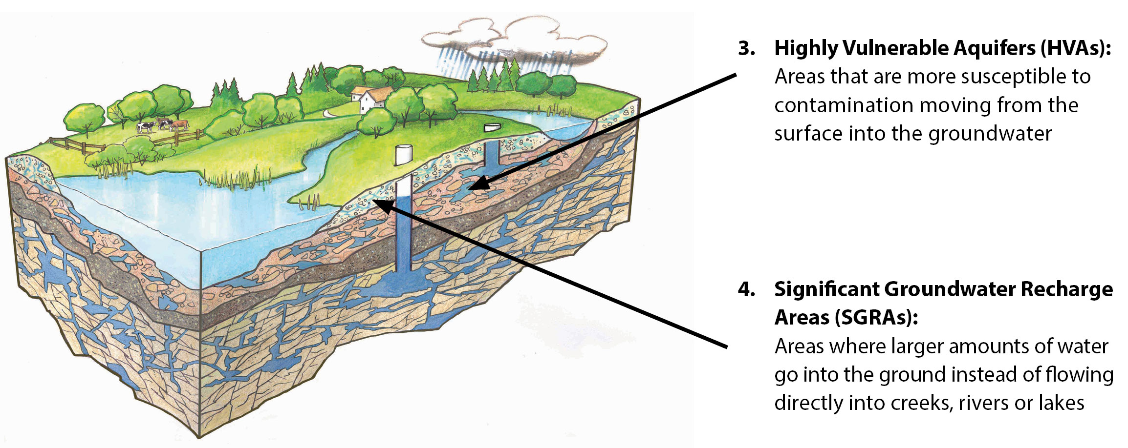
There are four types of areas under the Clean Water Act, 2006 that are considered vulnerable to contamination:
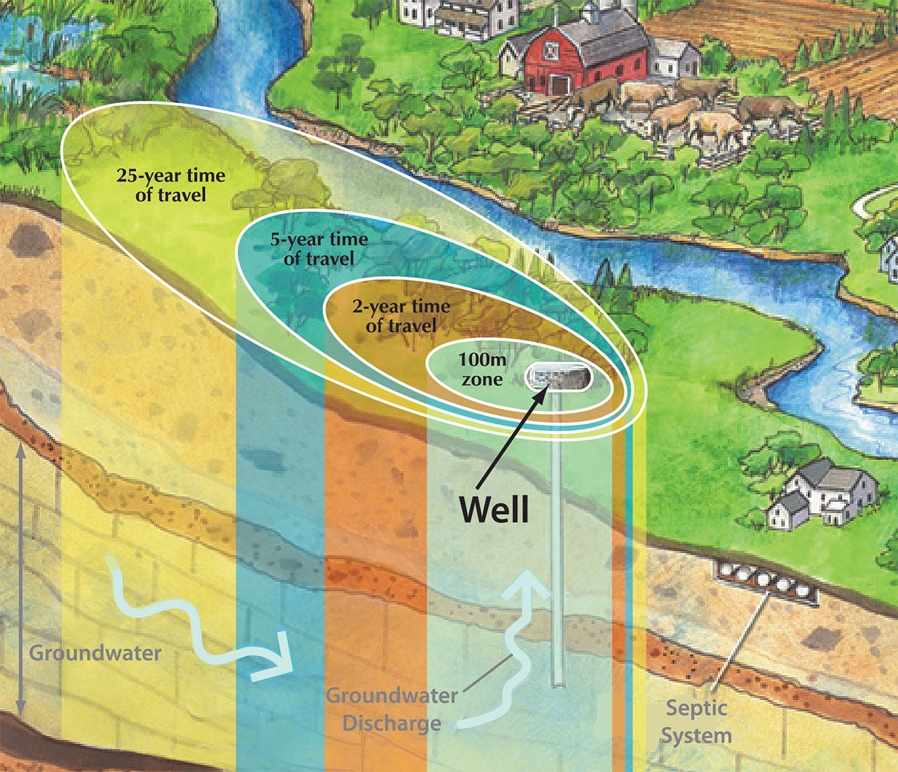
1. Wellhead Protection Areas (WHPAs): areas where water travels through the ground to a municipal well.
2. Intake Protection Zones (IPZs): areas around municipal surface water intakes.
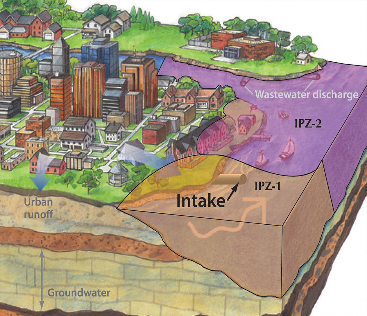
Every area that falls into one of these categories receives a Vulnerability Score, based on the risk of contamination. Generally speaking, the closer to the well or intake, the higher the score.
Source Water Protection Map
The Ministry of the Environment, Conservation and Parks has developed a Source Water Protection Information Atlas. This interactive mapping tool enables enables homeowners, developers, farm owners and municipalities to search any location to determine if it lies within a vulnerable area.
2. Determine What Activities Constitute Threats
The Clean Water Act, 2006 identifies 21 different activities that represent existing or potential threats to drinking water. These include livestock grazing or pasturing, the operation of waste disposal sites and septic systems, the handling and storage of fuel, pesticides and commercial fertilizers, and the use of road salt and aircraft de-icing chemicals. You can see the full list here.
Each activity receives a Hazard Score based on its potential to contaminate drinking water.
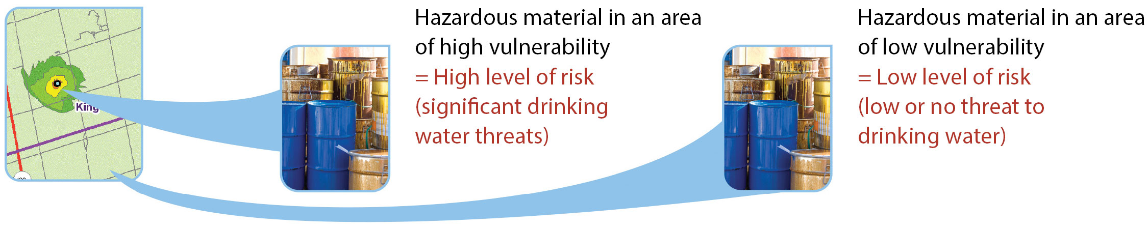
3. Calculate Threat Levels
We calculate threat levels by multiplying the Vulnerability Score of the area and the Hazard Score of the activity. If the resulting number is higher than 80, the activity is or could be a “significant threat” and must be addressed by the Source Protection Plan.
You can learn more about potential threats by downloading our Drinking Water Assessment guide.